Live GPS at WIAA State Cross Country Meet Made Possible by MSTC Students
For the City Times
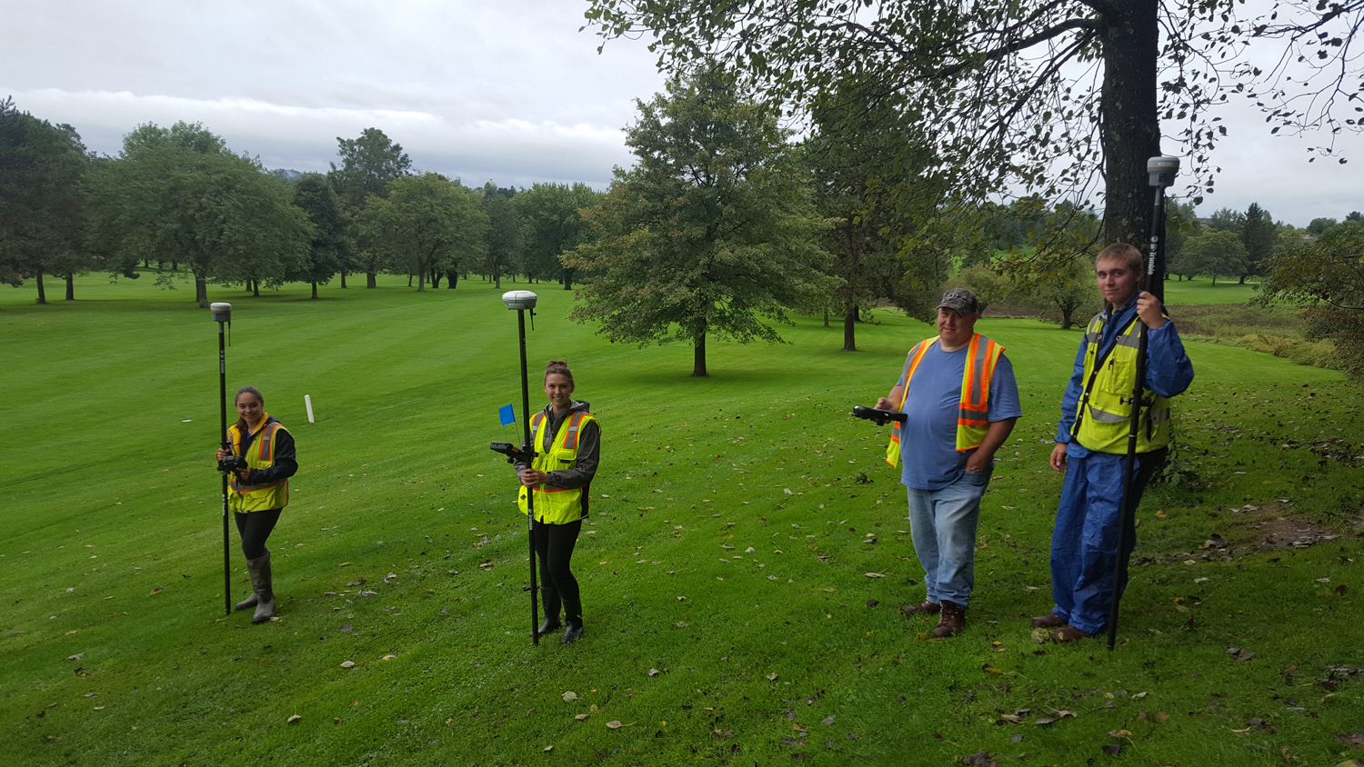
Spectators and medical first responders at this year’s Wisconsin Interscholastic Athletic Association state cross country meet at Ridges Golf Course were able to track their exact position on the course in real time thanks to a new live GPS map on their hand-held devices. The map of the 5,000-meter race course, created by Civil Engineering Technology-Highway Technician students at Mid-State Technical College, was accessed by 1,700 different users on October 29, the day of the race.
“It’s really nice that our guests are able to check their phones to navigate around the course and find the best vantage points throughout the race without getting lost or missing any action,” said Jim Newman, on-site coordinator of the state meet for 29 years. Newman noted that the GPS maps are especially useful given that the event draws over 10,000 spectators, many from outside the area and not familiar with Ridges. “This year, not one person asked me for directions,” he added. “And that is a first.”

(Contributed Photo)
Mid-State civil engineering students first surveyed the course in 2013 when instructor Greg Webster got the idea to combine his passion for the sport with a unique hands-on surveying experience for his students. “Because mapping a cross country course is similar to parts of the design process used for a road, I knew this would provide a great chance for them to practice their new skills in the real world,” he said.
Webster and his class used Trimble R8 and R10 GPS surveying equipment to collect approximately 2,400 data points, which allowed them to model the surface of the course and produce a highly accurate course map with an elevation profile. Runners and spectators use the resulting profile to visualize the course before race day and know where the more challenging parts of the course are.
Since 2013, the more-accurate map has become a hit with cross country race coordinators, and Webster’s classes have gone on to map three sectional courses at Standing Rocks Park in Plover, Skyline Golf Course in Black River Falls, and Nine Mile Forest in Wausau. In 2015, Webster started working with IT staff at the College to create the live, GPS-enabled versions of the maps that race spectators can access through a special website URL or QR code on their hand-held devices.
“It started with the state race, but when coordinators from the sectionals and invitationals started contacting about mapping their courses too, the concept really took off,” said Webster
“Maps of cross country race courses aren’t the only real-life surveying projects my Civil Engineering Technology-Highway Technician students have had the chance to work on, but they’ve definitely gotten the most enthusiastic response,” said Webster. “I really enjoy watching people using the maps on race day, knowing that my students and Mid-State made this contribution to the race experience.”
Already moving on to their next mapping projects, Webster’s Civil Engineering Technology-Highway Technician students have collected surface data for the Pittsville Invitational at Pittsville High school and the Rapids Invitational in Wisconsin Rapids, which will be supplemented with GIS data from Wood County. More information about the Civil Engineering Technology-Highway Technician program is at mstc.edu/programs.